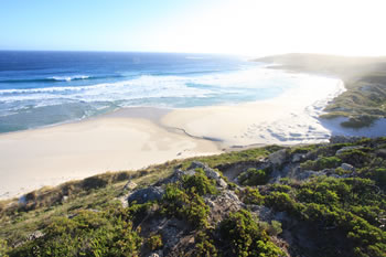


Mandalay Beach
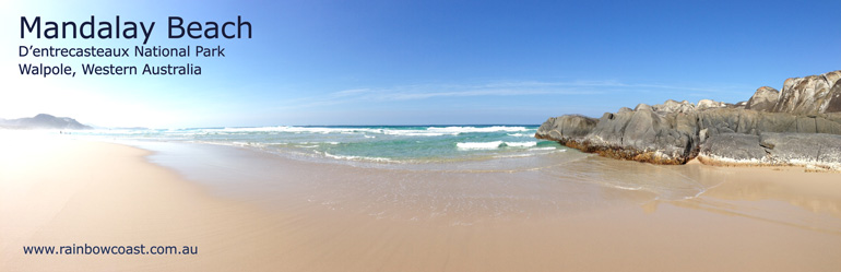
Mandalay Beach is well worth a visit, 30 minutes from Walpole, located on an unsealed road suitable for 2WD.
With spectacular views to Chatham Island, spectacular coastline and long white sandy beach
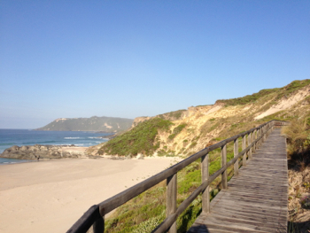
it is a must-see. The view from the boardwalk is spectacular including whale watching lookouts for the annual whale migration along the coast. Access to the beach is along a dune-side boardwalk which descends, in several flights, to the sand.
The beach is named for the three-masted Norwegian Barque "Mandalay" which was beached on the 15th of May 1911. The captain managed to beach the vessel and all aboard were saved! The shipwreck appears every decade or so as the beach erodes and then covers her again.
View the Map to Mandalay Beach below or Video.
The Boardwalk from the Mandalay Beach lookout onto Mandalay Beach is part of the Bibbulmun Track.
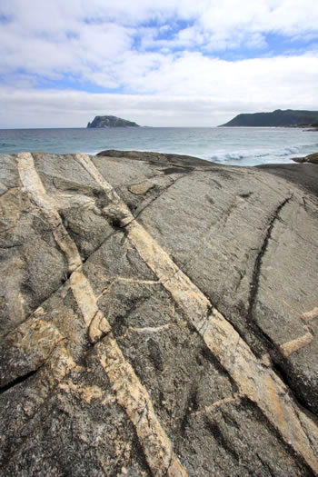
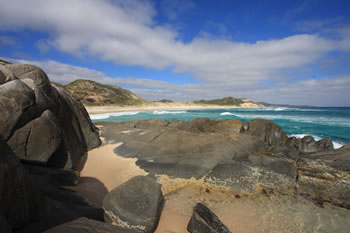
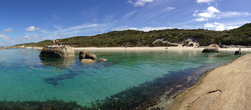
Chatham Island and Rock Formations from the far northern end of Mandalay Beach.
These geological formations are truly amazing. The area provides a wide range of nature-based recreational activities which complement the remote
nature and wilderness of the park.
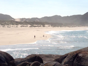
The photograph above of Mandalay Beach was taken from the rocks at the far northern end of the beach.
The coast from this point becomes impassable further north, turning into granite cliff faces and boulder fields.
The Bibbulmun Track walkers (heading north) take the boardwalk and continue overland for some kilometres. Surfing is also popular at the beach.
Entry to Mandalay Beach, D'Entrecasteaux National Park
D'Entrecasteaux National Park in Western Australia requires park access fees to enter. Camping fees are payable in addition to park entry fees, but campground only accessible by 4WD.
There are toilets but no picnic benches. The last 8k or so approaching the carpark for Mandalay Beach is on an unsealed road (dirt track) but is ok for regular vehicles including standard 2WD vehicles.
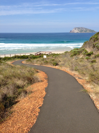
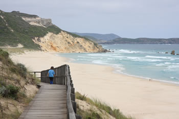
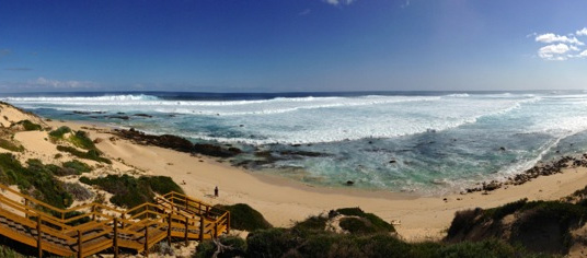
The path to the Mandalay Beach Lookout.
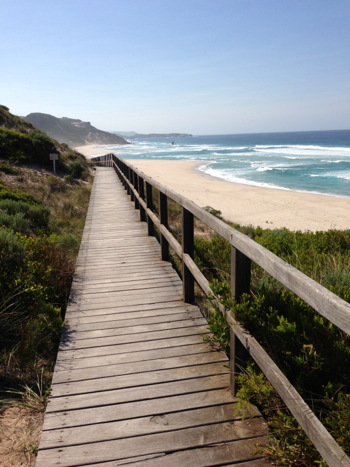
The boardwalk, part of the Bibbulmun Track, heading down to Mandalay Beach.
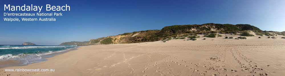
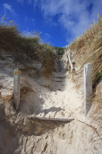
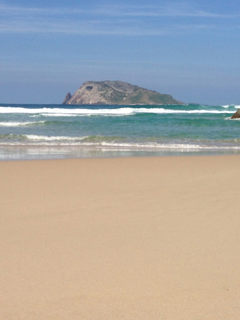
Photo of Mandalay Beach facing north with Chatham Island in the distance.
Banksia Camp, can only be accessed by 4WD and Camping fees apply.
The Banksia Hut is a roomy shelter, which cannot be pre-booked, with four bedrooms and a common area where 12 people can comfortably sleep. Campfires are permitted but ONLY when no restrictions apply and ONLY in the provided fire rings.
The natural beauty of Mandalay Beach is astounding. Huge stretches of white sandy beaches, in many cases untouched.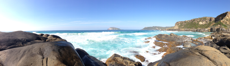
Fishing is a popular activity off Mandalay Beach: Anglers can expect to catch skippy, herring and whiting any time of the year and salmon or tailor in season.
Mandalay Beach has a path that takes you over the rocks on the northern side of the beach (right side) and offers amazing views of the large waves crashing along the coast.
BE CAREFUL and stay clear of the waterline.
Mandalay Rainbow
Mandalay Beach Map
Mandalay Beach Map
Tap the markers for information about the locations on the Map below.
What's on the map? These are the locations plotted above:
Mandalay Beach Spectacular views to Chatham Island, gorgeous white sandy beach it is a must-see... sometimes the shipwreck is visible too. Visit Mandalay Beach
Mandalay Beach Videos:
Attractions of D'Entrecasteaux National Park:
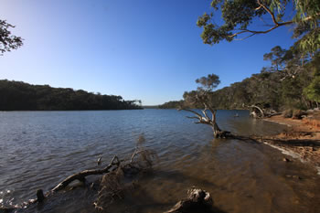
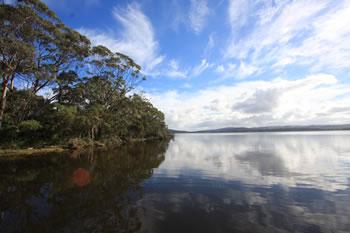
 Broke Inlet
 Broke Inlet is located in Dentrecasteaux National Park approximately 40km west northwest of Walpole Town. Visit Broke Inlet
Mandalay Beach Spectacular views to Chatham Island, gorgeous white sandy beach it is a must-see... sometimes the shipwreck is visible too. Visit Mandalay Beach
Other amazing locations in the South-West of Western Australia!
More information on the south-west coast in our other Western Australian travellers guides:
Albany Tourist Information:
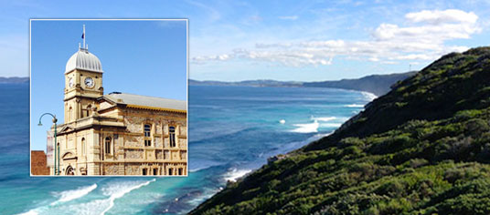
Albany WA
The Albany is the oldest settlement in Western Australia. Filled with history, surrounded by beaches and waterways, and a great place to visit while on holiday on the south coast of WA. Visit Albany today.
Have you visited?
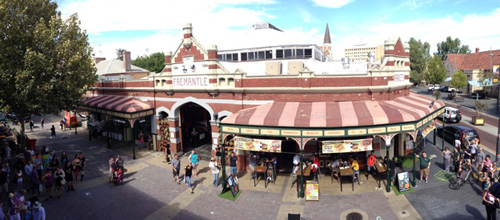
Fremantle WA
Fremantle, the Port City, is located south-west of Perth at the mouth of the Swan River. Fremantle's vibrant nightlife, music scene and cafe' culture make Fremantle a perfect getaway from the bustle of Perth. Beaches, history, shopping, dining out, and more. VISIT FREMANTLE
Have you visited?
Margaret River, WA
The Margaret River Region is an area of magnificent beauty on the western coast of the south west of WA. From the expansive shores of Busselton on Geographe Bay, through Dunsborough & Margaret River to Augusta, the Margaret River Region is fantastic. VISIT MARGARET RIVER
Have you visited?
Denmark WA
Denmark WA is one of the most beautiful places along the south coast as it has forests, beaches, rivers and waves. Everything you need for the perfect south coast holiday. Denmark Wineries are popular too! Info on Denmark Town including shopping, dining & history, VISIT DENMARK WA